
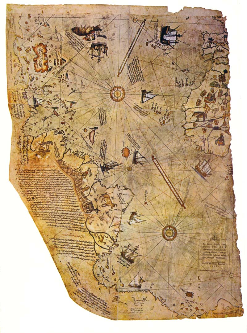
 In 1929, some historians found a crazy map drawn on a gazelle skin.
They found out that it wasn't bullshit and it was drawn in 1513 by Piri Reis, a famous admiral of the Turkish fleet in back in the day. I guess his rank gave him access to Constantinople's Imperial Library and he said he copied the maps from older shit he found. Stuff dating back to the fourth century BC and older.
Whats so crazy about this map is how accurate it is. It shows stuff that pro's today say could only have been done with aerial views of the areas that were mapped and the use of really advanced math. And they knew the earth was round and they knew its circumference.
Its representation of Antarctica is really nuts..
The northern coastline of Antarctica is perfectly detailed. The most puzzling however is not so much how Piri Reis managed to draw such an accurate map of the Antarctic region 300 years before it was discovered, but that the map shows the coastline under the ice. Geological evidence confirms that the latest date Queen Maud Land could have been charted in an ice-free state is 4000 BC.
While this article never mentions it, It implies it throughout. What I'm talking about is ALIENS. thats fucking right.
read this shit!
http://www.world-mysteries.com/sar_1.htm
This evidence of a lost technology will support and give credence to many of the other hypothesis that have been brought forward of a lost civilization in remote times. Scholars have been able to dismiss most of those evidences as mere myth, but here we have evidence that cannot be dismissed. The evidence requires that all the other evidences that have been brought forward in the past should be re-examined with an open mind." (Ibid.)
2 comments:
i hate aliens please they cant exisit.... they cant.
These sound delightful Old map.Your contents are progressing with days keep it up guys.
Post a Comment